Advertisements
Advertisements
प्रश्न
Answer in detail:
Explain with examples the process of weathering happening in Konkan.
उत्तर
- Konkan, also known as the Konkan Coast is a rugged, section of the western coastline of India.
- The region is divided into North Konkan, including Mumbai, Thane and Raigad districts whereas South Konkan include Ratnagiri and Sindhudurg districts.
- Laterite rocks occur in the form of plateaus at Konkan strip. High altitude laterite plateaus are found in Satara, Kolhapur, Ratnagiri, and Sindhudurg district.
- In the laterite rocks, soft silica matter is present.
- Because of high rainfall exposed rocks become empty to wash out of soft silica matter.
- Laterite soil is formed by laterite rock in high elevation. The soil contains has a high concentration of ferrous and aluminium. This soil is very stony because of the presence of weathering fragments of iron concentrations.
- Oxygen in the air and water reacts with certain elements in the minerals in the rock. The metals in the rock particularly iron and aluminium oxidise and form iron and aluminium oxides. Thus, chemical weathering takes place.
- Laterite soil is found in Mahabaleshwar, southern parts of Mahabaleshwar, around Bhima Shankar and Matheran. Thus, chemical and mechanical weathering is found.
APPEARS IN
संबंधित प्रश्न
Identify the correct correlation:
A: Assertion; R: Reasoning
A: Surface water helps solifluction.
R: Water table is responsible for the same.
Identify the correct group:
Draw a neat and labelled diagram of Freeze and thaw weathering
Draw a neat and labelled diagram of Block disintegration.
In which regions will freeze-thaw weathering not be effective?
Can animals and plants also influence weathering? Will that be physical or chemical weathering? Which type of weathering does stone quarrying cause?
See the diagram and answer the following questions:

- Which rock layer has experienced the most weathering?
- Which rock layer has experienced the least weathering?
- What could be the reason behind the difference in weathering?
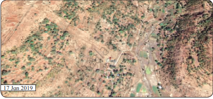
The satellite images are given in figure A and B belong to the same location but a different timeline. Study the images and answer the following questions.

Figure A

Figure B
- Compare the images and tell what differences do you find in these images.
- In 2019 what does the patch of land going from north-west to south-east signify? Why was it not there in the 2011 image?
- To what extent is the climate of the place responsible for this disaster?
- Which other factors are responsible for the disaster?
Study the following schematic diagram. It shows the relationship between the speed of material and moisture content. Read the index, and answer the following questions:

- Fast
- Slow
- Dry
- Wet
- Creep
- Slide
- Fall
- Flow
Question:
- What will happen when the weather conditions are dry?
- When will a flow occur?
- When will a creep occur?
- Now can you enumerate the factors which affect mass wasting?
Think of the reason why landslides should be more frequent in the foothill zone of the Himalayas and Western Ghat region. Why do landslides not occur in Marathwada in Maharashtra or the Maidan area in Karnataka?
