Advertisements
Advertisements
प्रश्न
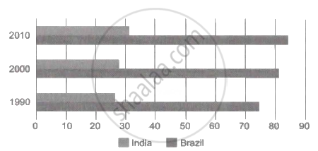
With the help of given statistical data showing the percentages of urbanisation in India and Brazil for three decades, prepare a simple bar graph and answer the following questions :
| Year | 1990 | 2000 | 2010 |
| Brazil | 74.6 | 81.5 | 84.6 |
| India | 25.7 | 27.8 | 31.2 |
- In which decade the trend of urbanization was higher in Brazil?
- In which decade does the urbanization in India appear to be rapid?
- Compare the differences in the percentages of urbanization in both countries. In which decade is the difference in the percentage of urbanization the highest?
उत्तर

- 2010
- 2010
- 2000
APPEARS IN
संबंधित प्रश्न
Answer in detail:
Explain in detail about urbanization in India .
Concentrated settlements are found in Narmada Valley because of ______
Give geographical reason.
Except Delhi and Chandigarh, urbanization is low in other parts of India.
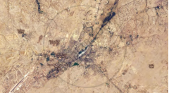
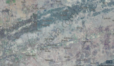
Tell whether settlements shown in images (a) and (b) are urban or rural.
|
(a) |
(b) |
Write a short note.
Comparison of urbanisation in Brazil and India
Prepare a line graph with the help of given statistical information and answer the questions given below-
India-trends of urbanization(%)
| Year | India |
| 1961 | 18.0 |
| 1971 | 18.2 |
| 1981 | 23.3 |
| 1991 | 25.7 |
| 2001 | 27.8 |
| 2011 | 31.2 |
Questions-
- In which year 18% urbanization is found?
- Urbanization has increased by how many percent from 2001 to 2011?
- In which decade was the growth of urbanization highest?
Find the correct pair.
Indian states with less than 20% urbanisation.
Find the correct pair.
Indian states with less than 61% to 80% urbanisation.
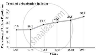
Read the graph given below and answer the following questions:
|
India-trend of urbanisation (1961-2011) |
- What was the percentage of urbanisation in 1961?
- In which decade was urbanisation the highest?
- In which decade was the growth of urbanisation lowest?
- What inference can you draw regarding India’s urbanisation after reading the graph?
Mark the following in the outline map of India. Write the names and give index:
- Union territory - Daman
- Heavy rainfall region to the west coast
- Cold desert
- Region to the north having high density of population
- Kanyakumari
- Chilka lake


