Advertisements
Advertisements
प्रश्न
Distinguish between:
The Eastern and the Western Ghats
उत्तर
Western Ghats:
- They extend from the mouth of river Tapi to Kanyakumari.
- The average height is 1,200 m but in some parts it rises to 2,440 m.
- They are continuous.
- They are the source of rivers that flow across the Deccan.
- They are steep and rugged, and rise abruptly from the arrow Western Coastal Plains.
- They lie close to the Arabian Sea.
Eastern Ghats:
- They extend from the Mahanadi Valley up to the Nilgiri Hills.
- The average height is 450 m, rarely exceeding 1,200 m.
- They are not continuous. Many rivers flow through them.
- They have gentle slopes that rise from the Eastern Coastal Plains.
- They lie at some distance from the Bay of Bengal.
APPEARS IN
संबंधित प्रश्न
Choose the right answer from the alternative given below.
The highest peak in the Eastern Ghats is
Answer the following question briefly.
Name the island group of India having coral origin.
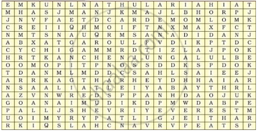
Locate the peaks, passes, ranges, plateaus, hills, and duns hidden in the puzzle. Try to find where these features are located. You may start your search horizontally, vertically or diagonally.

Identify who I am:
The longest river of south India:
Write a short note on the Thar desert.
Give Reasons:
The great Indian desert is called Marusthali.
______, ______ are the distributaries of the cauvery.
Mention the tributaries and distributaries of Cauvery.
Mention the tributaries of Godavari.
Read the following map and answer the questions given below.

Questions-
- The Vindhyas act as water divide between which two river basins?
- Write the name of the south flowing river of the peninsula.
- Write names of plateaus between Aravali mountain and Chotta Nagpur plateau.
- Name the peak shown in the Eastern Ghats.
- In which direction does the height of the Sahyadri hills increase?
