Advertisements
Advertisements
Question
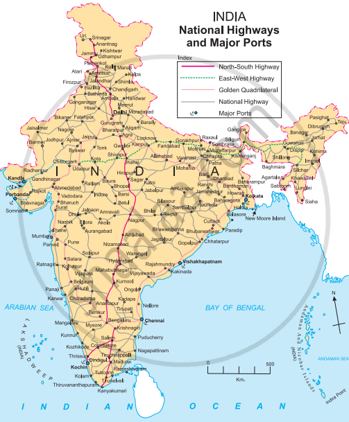
Look at the transport maps of India given in fig and answer the following questions.
 |
 |
- Which means of transport are visible on the map?
- In which part of India is the density of railways more?
- Name five important ports and airports of India.
- Which parts of India have a sparse network of transport? What could be the reason?
Short Note
Solution
- The means of transport visible on the map are waterways, railways and airways.
- The density of railways is more in the Northern Plains region.
- Ports: Mumbai ,Vishakhapatanam, Haldia, Chennai and Kandla.
Airports: Delhi, Mumbai, Bengaluru, Chennai, and Kolkata. - The north and the north-east parts of India have a sparse network of transport. Due to mountainous and snow covered areas in the north and the dense inaccesible forest areas of the north-east, the transportation network is sparse here. Also these regions have low population and lack of economic opportunities.
shaalaa.com
Is there an error in this question or solution?
