Advertisements
Chapters
2: Elements of a Map
3: Major Landforms of the Earth
4: Major Water Bodies
5: Types of Agriculture
6: Major Crops
7: Minerals and Ores Exercises
8: North America: Location, Area, Political and Physical Features
9: North America: Climate, Natural Vegetation, Wildlife; Mineral and Power Resources
10: South America: Location, Area, Political and Physical Features
11: South America: Climate, Natural Vegetation, Wildlife; Mineral and Power Resources
![Oxford University Press solutions for Voyage Geography [English] Class 6 chapter 1 - Maps and Diagrams Oxford University Press solutions for Voyage Geography [English] Class 6 chapter 1 - Maps and Diagrams - Shaalaa.com](/images/voyage-geography-english-class-6_6:095a8c00096845b1b8d5a92e89bd5fd3.jpg)
Advertisements
Solutions for Chapter 1: Maps and Diagrams
Below listed, you can find solutions for Chapter 1 of CISCE Oxford University Press for Voyage Geography [English] Class 6.
Oxford University Press solutions for Voyage Geography [English] Class 6 1 Maps and Diagrams Exercise
Choose the correct answer
Which of these is shown by a thematic map?
mountains
rivers
climate
state capitals
Choose the correct answer
These maps are useful to surveyors and civil engineers engaged in building roads, bridges, canals, and other structures.
physical
political
topographic
thematic
Choose the correct answer
This is a true model of the earth.
Sketch
Map
Globe
Plan
Choose the correct answer
This is a rough drawing showing the relative locations of a few features of an area
globe
map
sketch
plan
Choose the correct answer
This is a drawing that shows the horizontal section of a small area drawn to scale.
sketch
plan
map
globe
Choose the correct answer
These are taken from space and show that the earth is spherical in shape.
graphs
plans
aerial photographs
sketches
Explain the differences between the following pair.
An aerial photograph and a plan
Explain the differences between the following pair.
A globe and an atlas
Explain the differences between the following pair.
A sketch and a map
Define an atlas.
What do you understand by topographic maps?
Which map would be most useful to army personnel when constructing a bridge during a war?
How will you show the location of your house to a friend who is visiting you for the first time?
Differentiate between a plan and a sketch.
What is a map?
What are the different types of maps?
Describe a political and physical map.
Take the help of your atlas to make a list of thematic maps. Describe any two maps from your list.
What are the advantages and disadvantages of using a globe?
Draw a plan of your house showing clearly the position of each room in relation to the
others. On the plan, mark clearly the positions of doors, windows, and furniture.
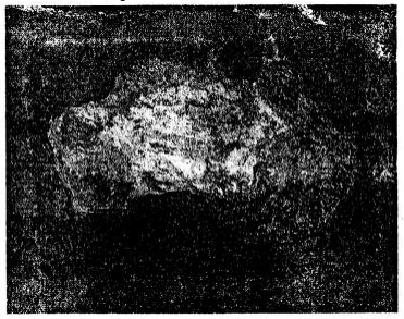
Picture study.

1 Do you know how this type of picture is taken?
2 What is it used for?
Solutions for 1: Maps and Diagrams
![Oxford University Press solutions for Voyage Geography [English] Class 6 chapter 1 - Maps and Diagrams Oxford University Press solutions for Voyage Geography [English] Class 6 chapter 1 - Maps and Diagrams - Shaalaa.com](/images/voyage-geography-english-class-6_6:095a8c00096845b1b8d5a92e89bd5fd3.jpg)
Oxford University Press solutions for Voyage Geography [English] Class 6 chapter 1 - Maps and Diagrams
Shaalaa.com has the CISCE Mathematics Voyage Geography [English] Class 6 CISCE solutions in a manner that help students grasp basic concepts better and faster. The detailed, step-by-step solutions will help you understand the concepts better and clarify any confusion. Oxford University Press solutions for Mathematics Voyage Geography [English] Class 6 CISCE 1 (Maps and Diagrams) include all questions with answers and detailed explanations. This will clear students' doubts about questions and improve their application skills while preparing for board exams.
Further, we at Shaalaa.com provide such solutions so students can prepare for written exams. Oxford University Press textbook solutions can be a core help for self-study and provide excellent self-help guidance for students.
Concepts covered in Voyage Geography [English] Class 6 chapter 1 Maps and Diagrams are Importance of Maps, Types of Maps Based on Scale, Scale Meaning and Uses, Direction: Eight Cardinal Points, Symbols, Diagrams (With Brief Explanation), Maps - Our Companions.
Using Oxford University Press Voyage Geography [English] Class 6 solutions Maps and Diagrams exercise by students is an easy way to prepare for the exams, as they involve solutions arranged chapter-wise and also page-wise. The questions involved in Oxford University Press Solutions are essential questions that can be asked in the final exam. Maximum CISCE Voyage Geography [English] Class 6 students prefer Oxford University Press Textbook Solutions to score more in exams.
Get the free view of Chapter 1, Maps and Diagrams Voyage Geography [English] Class 6 additional questions for Mathematics Voyage Geography [English] Class 6 CISCE, and you can use Shaalaa.com to keep it handy for your exam preparation.
