Topics
Field Visit
Location and Extent
Physiography and Drainage
- Physical Divisions of India
- The North Indian Mountains
- The Himalayas
- North Indian Plains
- The Peninsular Indian Plateau
- The Indian Coastal Plains
- The Indian Islands
- Physiography of Brazil
- Brazilian Highlands
- The Great Escarpment in Brazil
- Coastline of Brazil
- Brazilian Plains
- Brazilian Island
- Drainage of Brazil
- Drainage Systems of India
- Himalayan Rivers
- Peninsular Rivers
Climate
Natural Vegetation and Wildlife
Population
Human Settlements
Economy and Occupations
Tourism, Transport and Communication
Geography - Physical Divisions of India
Identification of Physical divisions
- Identification of Physical Divisions
Geography - North Indian Mountains
Himalayas
Associated mountains
- Concept of Associated Mountains
Geography - North Indian Plain Region
Deserts
- Desert
Western Plains
- Concept of Western Plains
Central Plains
- Concept on Central Plains
Delta region
- Concept of Delta Region
Eastern Plains
- Concept of Eastern Plains
Geography - Peninsular Plateau Region
Chhotta Nagpur Plateau
- Concept for Chhotta Nagpur Plateau
Malwa Plateau
- Concept on Malwa Plateau
Maharashtra Plateau
- Concept for Maharashtra Plateau
Karnataka Plateau
- Concept for Karnataka Plateau
Telangana Plateau
- Concept for Telangana Plateau
Geography - Western Ghats and Eastern Ghats
Eastern Ghats
- Concept on Eastern Ghats
Sahyadries
- Concept on Sahyadries
Geography - Coastal Region
- Geography - Coastal Region
Eastern coastal plain
- Coastal Region - Eastern Coastal Plain
- Concept for Western Coastal Plain
Western coastal plain
- Concept for Western Coastal Plain
Geography - Indian Islands
- Geography - Indian Islands
Eastern Islands
- Indian Islands - Eastern Islands
Western Islands
- Indian Islands - Western Islands
Geography - Practical 1
Cartography
- Concept on Cartography
Geography - Practical 2
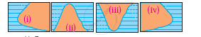
Two dimensional diagrams
- Two Dimensional Shapes
One dimensional diagrams
- Concept on One Dimensional Diagrams
Economics - Introduction of an Economy
Introduction of an Economy
- Economy
- Types of Economy
- Main Features of Economy
Economics - Basic problems of an economy solution
Solutions
- Concept for Capitalism
- Concept for Socialism
- Mixed Economy
Problems
- Introduction of Basic Problems of an Economy
- Problems- for Whom to Produce
- Problem - How Much to Produce
- Problem - by Whom to Produce
Economics - Inflation
Introduction
- Introduction of Inflation
Effects of inflation
- Effects of Inflation
Measures of Inflation
- Measures of Inflation
Causes of inflation
- Causes of Inflation
Economics - Public distribution system and consumer protection
- Measures of Inflation
Public Distribution system - meaning and explanation
- Public Distribution System - Meaning and Explanation
Introduction
- Introduction of Public Distribution System and Consumer Protection
Objectives of Public Distribution system
- Objectives of Public Distribution System
Remedial Measures
- Remedial Measures Public Distribution System and Consumer Protection
Consumer Protection
- Consumer Protection - Rights and Duties of Cunsumer, Food Adulteration
Drawbacks of Public Distribution system
- Drawbacks of Public Distribution System
Progress of Public Distribution system
- Progress of Public Distribution System
- Indian : Location, Size and Extent
- Indian Standard Time (IST)
Indian - Location and Extent
|
India: Extent and Standard Meridian |

Location:
- India is a very large country. It is situated in the southern part of the Asian continent.
- India's latitudes range from 8°4'N to 37°6'N, and its longitudes range from 68°7'E to 97°25'E. As a result, India is located in the northeastern hemisphere.
- The Tropic of Cancer (23° 30'N) divides the country almost evenly. Thus, half of the country south of the Tropic of Cancer is in the Tropical region, while the other half north is in the Sub-tropical region.
Size and Extent:
- The land mass of India has an area of 3.28 million square km. It is the world's seventh-largest country. India's total area accounts for approximately 2.4 per cent of the world's total geographical area.
- India's north-south extent is 3,214 km, stretching from Indira Col in Jammu and Kashmir in the north to Kanyakumari in the south.
- The east-west extension is 2933 kilometres long, stretching from Rann of Kutch in Gujarat to Arunachal Pradesh in the east.
- Pygmalion Point or Indira Point (6°45'N latitude) in the Andaman and Nicobar Islands is the country's southernmost point. During the 2004 Tsunami, it was submerged under seawater. Cape Comorin is the southernmost point of India's mainland (Kanyakumari).
- Indira Col is the northernmost point.
Indian Standard Time (IST):
- The longitudinal difference between Gujarat in the west and Arunachal Pradesh in the east is approximately 30°.
- Because Arunachal Pradesh is to the east, its sunrise will be about two hours earlier than that of Gujarat, which is to the west.
- To avoid these discrepancies, Indian standard time is used. The standard time in India is the local time of the central meridian.
- The central meridian of India is located at 82°30' E longitude. It passes through Mirzapur, near Allahabad, and roughly cuts the country in half in terms of longitude.
- The IST is 5.30 hrs ahead of Greenwich Mean Time (GMT).
If you would like to contribute notes or other learning material, please submit them using the button below.