Advertisements
Advertisements
प्रश्न
Describe the latitudinal and longitudinal extent of India and Brazil.
उत्तर १
- Longitudinal and latitudinal extent of Brazil: Brazil being the 5th largest country in the world. The longitudinal extent of Brazil is an area of 4,319 kilometres from east to west, 34°47'30" E to 73°59'32" W (34 degrees 47 minutes 30 seconds E to 73 degrees 59 minutes 32 seconds W longitude), and the latitudinal extent of Brazil extends 4,395 kilometres from north to south, 5°16'N to 33°44'S (5 degrees 16 minutes 20 seconds N to 33 degrees 44 minutes 32 seconds S latitude).
- Longitudinal and latitudinal extent of India: India being one of the biggest countries in Asia. The longitudinal extent of India has an area of 2933 kilometres from east to west. 68°7' E to 97°25' E (68 degrees 7 minutes E to 97 degrees 25 minutes E longitude) and the Latitudinal extent of India extends 3214 kilometers from North to South 37°6' N to 8°4' N (37 degrees 6 minutes N to 8 degrees 4 minutes N latitude)
The difference in the longitudinal and latitudinal extent of India and Brazil is ≅ 10 degrees, with Brazil being longer.
उत्तर २
The latitudinal and longitudinal extent of India and Brazil is as follows:
| Latitudinal extent | Longitudinal extent | |
| India | 8° 4' N to 37° 6' N latitude | 68° 7' E to 97° 25' E longitude |
| Brazil | 5° 15' N to 33° 45' S latitude | 34° 47' W to 73° 48' W longitude |
Indira Point is the southernmost tip of India, and it is located on the 6°45'N parallel.
APPEARS IN
संबंधित प्रश्न
Match the column.
| A group | B group |
| 1) The southernmost point of India | 1) Gangotri |
| 2) The highlands in eastern Brazil | 2) Andes mountains |
| 3) The origin of Ganga | 3) Guyana Highlands |
| 4) the origin of Amazon | 4) Indira Point |
| 5) Yamunotri | |
| 6) The Great Escarpment |
The easternmost longitude of India is
Which of the following shapes show the coastal part of India correctly?

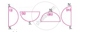
Considering hemisphere, which shape correctly represents the hemisphere in which India lies?

Answer the following question in brief:
Do you think it is right to use the term ‘subcontinent’ for India and its neighbouring countries?
The tropic of Cancer does not pass through which state?
The Standard Meridian of India passes through Mirzapur, it is located in which state of India.
Which is the smallest state of India area-wise?
Which river has the largest inhabited riverine islands in the world?
India is the ______ largest country in Asia.
