Advertisements
Advertisements
प्रश्न
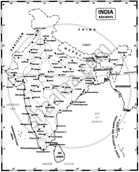
On the outline map of India mark the following
- National Highway NH-44
- Major seaports in India.
- Major International Airports in India.
- Densely populated state of India.
- State of highest literacy in India
- Railways zones of India.
उत्तर
1. National Highway NH-7.
3. Major International Airports in India.

2. Major seaports in India.
4. Densely populated state of India.
5. State of highest literacy in India.

6. Railway zones of India

APPEARS IN
संबंधित प्रश्न
The transport useful in the inaccessible areas is ______.
State the merits of Roadways.
Why is air travel preferred in the northeastern states?
The first railway line was laid between ______ in 1853.
The highways connecting the four metropolitan cities - Chennai, Mumbai, Delhi, and Kolkata.
Which mode of transportation reduces trans-shipment losses and delays.
The Indian National Highways are maintained by the department of ______.
World has become a global village due to which of the following?
There are ______ major ports located on the coastline of India.
Distinguish between National and State Highways.
