Advertisements
Advertisements
प्रश्न
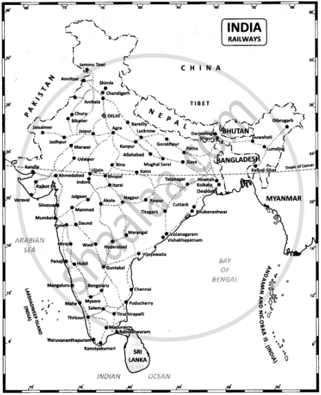
On the outline map of India mark the following
- National Highway NH-44
- Major seaports in India.
- Major International Airports in India.
- Densely populated state of India.
- State of highest literacy in India
- Railways zones of India.
उत्तर
1. National Highway NH-7.
3. Major International Airports in India.

2. Major seaports in India.
4. Densely populated state of India.
5. State of highest literacy in India.

6. Railway zones of India

APPEARS IN
संबंधित प्रश्न
State the merits of Roadways.
Find out what are the functions of NHAI.
Why is air travel preferred in the northeastern states?
There are ______ major ports located on the coastline of India.
Crude oil, petroleum, and natural gas are transported by ______.
Indian railway system is the ______ in Asia.
River Ganga is navigable up to ______.
The ______ have more railways than the Himalayan Mountains.
A cost-efficient and most popular mode of transport in our country is ______.
The costliest and most modern means of transport is ______.
