Advertisements
Advertisements
प्रश्न
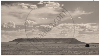
Identify the image given below and explain the formation of this geological division in India.

उत्तर
This image depicts a Plateau.
During the Pre Cambrian era, there was a large depression in which sediment were deposited and a block of crystal rocks came out of this depression. It behaved like rigid inflexible block throughout the geological history to form the Peninsular Plateau of India.
APPEARS IN
संबंधित प्रश्न
Name the four Indian geological eras in their chronological order.
Briefly explain the geological evolution of the Himalayas.
Name any two standard geological eras, along with their duration.
Answer the following question.
Explain the formation of Himalayas with reference to the theory of Plate Tectonics.
Answer the following question:
Briefly explain the geological evolution of the peninsular plateau.
(i) Where is the New Mangalore Port located?
(ii) What is the chief importance of this port?
Name the following :
A pilgrimage center in Himachal Pradesh.
The main Standard geological era is ______.
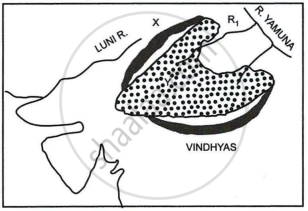
Study the sketch map given below and answer the questions that follow:

- Identify the dotted region marked Y. Mention any three of its characteristic features.
- Name the mountain range marked X, the river marked R1 and the type of rock that constitutes the dotted region.
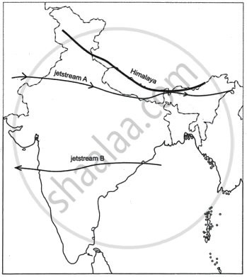
Study the sketch map given below and answer the questions that follow:

- State the direction of the movement of the jetstreams A and B in the Indian region. Give reasons for the same.
- How do the jetstreams A and B influence the Indian climate?
