Advertisements
Advertisements
Question
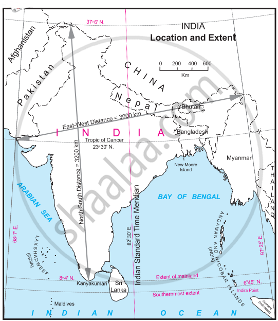
Observe the map and answer the questions given below:

Questions:
- What does the given map show?
- Name the Southernmost point of India.
- What is the East-West distance of India?
- Which longitude in India is called the Indian Standard Time?
- Name the Sea to the West of India.
Long Answer
Solution
- The given map shows the location and extent of India, including its longitudinal and latitudinal boundaries, important geographical features, and neighbouring countries.
- The southernmost point of India is Indira Point, located in the Nicobar Islands. However, if referring to mainland India, the southernmost point is Kanyakumari (Tamil Nadu).
- The east-west distance of India is 3000 km.
- The Indian Standard Time (IST) is based on the 82°30′E longitude, which passes through Mirzapur, Uttar Pradesh.
- The sea to the west of India is the Arabian Sea.
shaalaa.com
Is there an error in this question or solution?
