Advertisements
Advertisements
Question
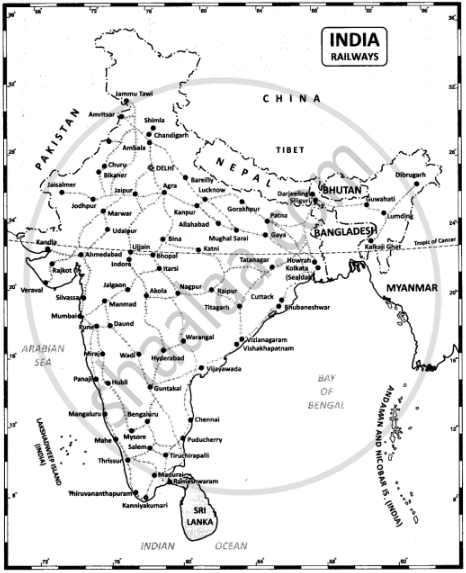
On the outline map of India mark the following
- National Highway NH-44
- Major seaports in India.
- Major International Airports in India.
- Densely populated state of India.
- State of highest literacy in India
- Railways zones of India.
Solution
1. National Highway NH-7.
3. Major International Airports in India.

2. Major seaports in India.
4. Densely populated state of India.
5. State of highest literacy in India.

6. Railway zones of India
APPEARS IN
RELATED QUESTIONS
Name them on the basis of the given information:
Five cities with airways services in Maharashtra
The length of Golden Quadrilateral superhighways in India is ______.
The first railway line was laid between ______ in 1853.
Indian Railways is organized into ______ zones for operations and management.
The National Highway No. 1 is also known as ______.
It is easier to construct and maintain ______.
Under transport, the ______ forms the lifeline of the country.
Name the three major means of transport in the world?
Match the Column I with Column II
| Column I | Column II | ||
| A | Megacity | (i) | Highest roadway |
| B | Transport system | (ii) | Quick delivery of mails |
| C | Delhi - Agra | (iii) | Mumbai |
| D | Chandigarh - Leh | (iv) | Lifeline of country |
| E | Metro channel | (v) | Express way |
Describe the importance of pipelines in India. Name three important networks of pipeline transportation in the country.
