Advertisements
Chapters
2: Population
3: Migration
4: Urbanization
5: Natural and Man-made Disasters with Case Studies
6: Disaster Management
7: Asia: Location, Extent, Political and Physical Features
8: Asia: Climate and Natural Vegetation
▶ 9: India: Location, Extent, Political and Physical Features
10: India: Climate, Natural Vegetation, Forests and Wildlife
11: Human Resources in India
![Oxford University Press solutions for Voyage Geography [English] Class 8 chapter 9 - India: Location, Extent, Political and Physical Features - Shaalaa.com](/images/voyage-geography-english-class-8_6:8252e9b8eb0c48bba3b0177d4ba41329.jpg "Oxford University Press solutions for Voyage Geography [English] Class 8 chapter 9 - India: Location, Extent, Political and Physical Features")
Advertisements
Solutions for Chapter 9: India: Location, Extent, Political and Physical Features
Below listed, you can find solutions for Chapter 9 of CISCE Oxford University Press for Voyage Geography [English] Class 8.
Oxford University Press solutions for Voyage Geography [English] Class 8 9 India: Location, Extent, Political and Physical Features Fill in the blanks
Fill in the blank:
There are 28 ______ and 8 union territories in India.
Fill in the blank:
The __________ divides India into two halves
Fill in the blank:
The Himalayas literally means _____________.
Fill in the blank:
The Lakshadweep Islands have been formed by the growth of _______.
Oxford University Press solutions for Voyage Geography [English] Class 8 9 India: Location, Extent, Political and Physical Features Identify who I am
Identify who I am:
A river that divides the Peninsular Plateau of India into the Malwa and the Deccan plateaux :
Identify who I am:
A vast sandy low-lying plain in north-west Rajasthan :
Identify who I am:
__________ Island is the only volcanically active island of India.
Identify who I am:
The longest river of south India:
Oxford University Press solutions for Voyage Geography [English] Class 8 9 India: Location, Extent, Political and Physical Features Distinguish between each of the pairs
Distinguish between:
The Eastern and the Western Ghats
Distinguish between:
The Eastern and the Western Coastal Plains
Distinguish between:
The Himalayan and peninsular rivers
Distinguish between:
The east and the west-flowing rivers of south India.
Oxford University Press solutions for Voyage Geography [English] Class 8 9 India: Location, Extent, Political and Physical Features Answer the questions in brief
Answer the following question in brief:
Do you think it is right to use the term ‘subcontinent’ for India and its neighbouring countries?
Answer the following question in brief:
On what basis were the states reorganized after Independence?
Answer the following question in brief:
What do you know about the Purvanchal ranges?
Answer the following question in brief:
Name the three divisions of the Great Northern Plains and the rivers responsible for their formation.
Oxford University Press solutions for Voyage Geography [English] Class 8 9 India: Location, Extent, Political and Physical Features Answer the questions in one or two paragraph
Answer the following question in one or two paragraphs:
Explain how India has benefited from its location.
Answer the following question in one or two paragraphs:
Explain how the Himalayas have greatly influenced the life of the people of India.
Answer the following question in one or two paragraphs:
Explain why the Great Northern Plains are densely populated.
Answer the following question in one or two paragraphs:
Describe the Andaman and Nicobar Islands, and the Lakshadweep Islands.
Oxford University Press solutions for Voyage Geography [English] Class 8 9 India: Location, Extent, Political and Physical Features Picture study
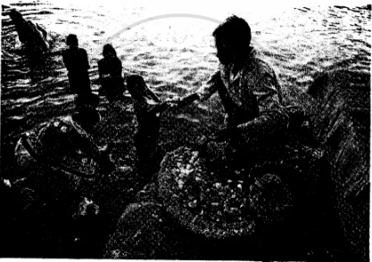
This is a photograph of the river Ganga.
Which are the states through which this river flows?
This is a photograph of the river Ganga.
Name any two left-bank tributaries of the river.
Oxford University Press solutions for Voyage Geography [English] Class 8 9 India: Location, Extent, Political and Physical Features Map work
Mark and label each of the following in an outline map of India
- The Tropic of Cancer
- The neighbouring countries of India
- The Palk Strait
- The Arabian Sea and the Bay of Bengal
Oxford University Press solutions for Voyage Geography [English] Class 8 9 India: Location, Extent, Political and Physical Features Extra Questions
Describe the location of India.
Name the countries that form the India subcontinent.
What is the percentage of the urban and rural population in India?
What is taken as the standard meridian for India and why?
Name the neighbouring countries of India.
What separates India from Sri Lanka?
Name the three water bodies which surround the India Peninsular.
On what basis were the states of India reorganised after independence?
Name the states and union territories of India along with their capitals. (Political divisions).
Name the point in the Himalayas where the boundaries of five countries meet. Name the countries.
Name the six main physical divisions of India.
What do the Northern Mountains consist of?
The Himalayas are rising even now. Comment.
Name the three main ranges of the Himalayas. Compare them.
Name a few passes or gaps in the Himalayas that serve as important passages through the northern mountain wall.
What is the location and extent of the Great Northern Plains? Which rivers have formed it?
Where do the Ganga and the Brahmaputra join and where do they drain?
Write a short note on the Peninsular Plateau.
How have the rocks of the Deccan Plateau formed?
Write a short note on the Thar desert.
Name the two categories of rivers of India.
Name the five tributaries of river Indus.
Name the states from where the river Indus, Ganga, and Brahmaputra flow in India.
Which river is called the ‘Ganga of the South’?
Define the following:
Alluvial plain
Define the following:
A Pass
Define the following:
Tributary
How are rivers important to humans?
Fill in the blank:
India is a part of the continent of _______.
Fill in the blanks:
India is ______ largest country and has _________ largest population in the world.
Fill in the blanks:
India lies entirely in the _________and _______hemispheres.
Fill in the blank:
The ________ longitude is the Standard Meridian for India.
Fill in the blank:
The __________separate India from the rest of Asia.
Fill in the blank:
___________ is the point in the Himalayas where the boundaries of five countries meet.
Fill in the blank:
______ is referred to as the National Capital Territory of India.
Fill in the blank:
The ________are the source of perennial rivers such as the Indus, the Ganga, and the Brahmaputra rivers.
Fill in the blank:
The __________ extend from Punjab in the west to the Brahmaputra Valley in the east.
Fill in the blank:
The _________soil of the river valleys/plains is very fertile.
Fill in the blank:
The largest delta in the world built by the Ganga and the Brahmaputra is ___________.
Fill in the blank:
The Peninsular Plateau of India is _______ in shape.
Fill in the blank:
On either side of the Peninsular Plateau of India are the _________ of India.
Fill in the blank:
___________ grow profusely in the Coastal Plains of India.
Fill in the blank:
The Thar Desert receives less than ____ cm rain annually.
Fill in the blank:
_______ is the only significant river in the Thar desert but carries very little water.
Fill in the blank:
The Andaman and Nicobar Islands are separated by a wide channel called the _________ channel.
Fill in the blank:
The ____________Islands lie at a distance of 200-400 km from the Malabar Coast.
Fill in the blank:
____________________ is the smallest union territory of India.
Fill in the blank:
The river Indus and river Brahmaputra originate in _____ before entering India.
Fill in the blank:
The river Ganga has its source in the ________glacier.
Fill in the blank:
River Brahmaputra enters India in _________ from Tibet.
Fill in the blank:
The west-flowing rivers of the Peninsular rivers drain into the _________.
Fill in the blanks:
The margins of the Deccan Plateau consist of hills called the ________ in the east and the ________ in the west.
Oxford University Press solutions for Voyage Geography [English] Class 8 9 India: Location, Extent, Political and Physical Features Map Skills
On a Political Map of India, show all the States and Union territories of India along with their Capitals.
On an outline map of India, show the important physical features.
Solutions for 9: India: Location, Extent, Political and Physical Features
Oxford University Press solutions for Voyage Geography [English] Class 8 chapter 9 - India: Location, Extent, Political and Physical Features
Shaalaa.com has the CISCE Mathematics Voyage Geography [English] Class 8 CISCE solutions in a manner that help students grasp basic concepts better and faster. The detailed, step-by-step solutions will help you understand the concepts better and clarify any confusion. Oxford University Press solutions for Mathematics Voyage Geography [English] Class 8 CISCE 9 (India: Location, Extent, Political and Physical Features) include all questions with answers and detailed explanations. This will clear students' doubts about questions and improve their application skills while preparing for board exams.
Further, we at Shaalaa.com provide such solutions so students can prepare for written exams. Oxford University Press textbook solutions can be a core help for self-study and provide excellent self-help guidance for students.
Concepts covered in Voyage Geography [English] Class 8 chapter 9 India: Location, Extent, Political and Physical Features are Political Divisions of India, Conservation of Forest and Wildlife in India, Climate and Natural Vegetation, Indian - Location, Size and Extent, Physical Divisions of India.
Using Oxford University Press Voyage Geography [English] Class 8 solutions India: Location, Extent, Political and Physical Features exercise by students is an easy way to prepare for the exams, as they involve solutions arranged chapter-wise and also page-wise. The questions involved in Oxford University Press Solutions are essential questions that can be asked in the final exam. Maximum CISCE Voyage Geography [English] Class 8 students prefer Oxford University Press Textbook Solutions to score more in exams.
Get the free view of Chapter 9, India: Location, Extent, Political and Physical Features Voyage Geography [English] Class 8 additional questions for Mathematics Voyage Geography [English] Class 8 CISCE, and you can use Shaalaa.com to keep it handy for your exam preparation.
