Topics
Field Visit
Location and Extent
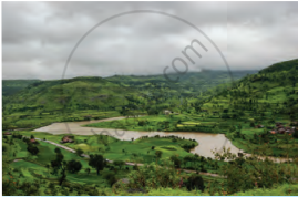
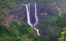
Physiography and Drainage
- Physical Divisions of India
- The North Indian Mountains
- The Himalayas
- North Indian Plains
- The Peninsular Indian Plateau
- The Indian Coastal Plains
- The Indian Islands
- Physiography of Brazil
- Brazilian Highlands
- The Great Escarpment in Brazil
- Coastline of Brazil
- Brazilian Plains
- Brazilian Island
- Drainage of Brazil
- Drainage Systems of India
- Himalayan Rivers
- Peninsular Rivers
Climate
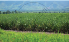
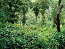
Natural Vegetation and Wildlife
Population
Human Settlements
Economy and Occupations
Tourism, Transport and Communication
Geography - Physical Divisions of India
Identification of Physical divisions
- Identification of Physical Divisions
Geography - North Indian Mountains
Himalayas
Associated mountains
- Concept of Associated Mountains
Geography - North Indian Plain Region
Deserts
- Desert
Western Plains
- Concept of Western Plains
Central Plains
- Concept on Central Plains
Delta region
- Concept of Delta Region
Eastern Plains
- Concept of Eastern Plains
Geography - Peninsular Plateau Region
Chhotta Nagpur Plateau
- Concept for Chhotta Nagpur Plateau
Malwa Plateau
- Concept on Malwa Plateau
Maharashtra Plateau
- Concept for Maharashtra Plateau
Karnataka Plateau
- Concept for Karnataka Plateau
Telangana Plateau
- Concept for Telangana Plateau
Geography - Western Ghats and Eastern Ghats
Eastern Ghats
- Concept on Eastern Ghats
Sahyadries
- Concept on Sahyadries
Geography - Coastal Region
- Geography - Coastal Region
Eastern coastal plain
- Coastal Region - Eastern Coastal Plain
- Concept for Western Coastal Plain
Western coastal plain
- Concept for Western Coastal Plain
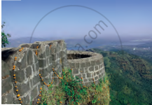
Geography - Indian Islands
- Geography - Indian Islands
Eastern Islands
- Indian Islands - Eastern Islands
Western Islands
- Indian Islands - Western Islands
Geography - Practical 1
Cartography
- Concept on Cartography
Geography - Practical 2
Two dimensional diagrams
- Two Dimensional Shapes
One dimensional diagrams
- Concept on One Dimensional Diagrams
Economics - Introduction of an Economy
Introduction of an Economy
- Economy
- Types of Economy
- Main Features of Economy
Economics - Basic problems of an economy solution
Solutions
- Concept for Capitalism
- Concept for Socialism
- Mixed Economy
Problems
- Introduction of Basic Problems of an Economy
- Problems- for Whom to Produce
- Problem - How Much to Produce
- Problem - by Whom to Produce
Economics - Inflation
Introduction
- Introduction of Inflation
Effects of inflation
- Effects of Inflation
Measures of Inflation
- Measures of Inflation
Causes of inflation
- Causes of Inflation
Economics - Public distribution system and consumer protection
- Measures of Inflation
Public Distribution system - meaning and explanation
- Public Distribution System - Meaning and Explanation
Introduction
- Introduction of Public Distribution System and Consumer Protection
Objectives of Public Distribution system
- Objectives of Public Distribution System
Remedial Measures
- Remedial Measures Public Distribution System and Consumer Protection
Consumer Protection
- Consumer Protection - Rights and Duties of Cunsumer, Food Adulteration
Drawbacks of Public Distribution system
- Drawbacks of Public Distribution System
Progress of Public Distribution system
- Progress of Public Distribution System
Report Writing:
After the visit is over, information should be gathered on which to base a field report. The following information is provided regarding report writing:
- Basis -
- Information collected from the field visit
- Photographs
- Maps
- Information Charts
- The questionnaire used for interviewing, etc.
- Format of Field Report:
- Title, Category
- Introduction
- Location map and Route Map
- Purpose, Objectives, and Significance of the field trip or tour
- Gathering and presenting information on a field with regard to physiography, rivers, climate, population, rainfall, crops, natural vegetation, etc.
- Conclusion, bibliography, etc.
Sample of Field Visit:
Field Visit at "Alibag, Raigad district"Category - Educational Purpose |
|||||||||||||||||
|
Introduction: Mahatma Jhyotiba Phule School organized a field visit from Naldurg in the Osmanabad district to Alibag in the Raigad district for SSC final-year students on 15/12/2022 (Thursday). The school has engaged a special bus from State Transport for this purpose. |
|||||||||||||||||
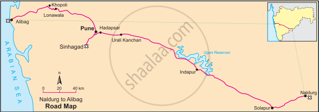
| Route Map:
|
|||||||||||||||||
Objectives:
|
|||||||||||||||||
Information:
|
|||||||||||||||||
Conclusion:
|
|||||||||||||||||

If you would like to contribute notes or other learning material, please submit them using the button below.
